

Hiking trails
The best hiking trails in Spain
Hiking
Our best Hiking trails
Boñar is pure hiking, all year round!
Enjoying the natural world
The municipality of Boñar has a varied offer of hiking trails with various types of difficulty, sizes and to be enjoyed in groups, with the family or alone.

Our Trails
Easy
Moderate
OTher Trails
Check the weather before you go…
Information prepared by the State Meteorological Agency. Ministry of Agriculture, Food and Environment.


Easy
Easy Routes
LITTLE EFFORT, LOTS OF FUN!
These trails are characterised by a low level of difficulty and are particularly suitable for a walk alone or with the family, without much effort.
PRC-LE 56
Por el Río Porma
Leaving Cerecedo, we begin the ascent to Valdecastillo, following the river Porma along its right bank…
Trail with Water
Trail with Water
Boñar, is where the water flows the most. For this reason, this urban trail has been created to enhance the value of…
Searching north
4 Cardinal Points
Hiking trail created to enjoy one of the best panoramic views of the village of Boñar. Peña Salona…
SL-LE 1
Cascada de Foces
The trail starts at the municipal recreational area of El Soto de Boñar, crossing the bridge towards Barrio las Ollas on the…
SL-LE 2
Cota del Campillo
The trail of the Cota de Campillo, runs in the surroundings of the Porma Reservoir. Its track, a little more than 6 km…
SL-LE 3
Rucayo a Utrero (Literary trail)
The trail SL-LE 3 Camino a Utrero from Rucayo flows in the middle of the Cantabrian Mountain Range, between the…
SL-LE 4
La ermita de San Pelayo
The SL-LE 4 trail, “Ruta Ermita San Pelayo”, next to the Picos de Europa Regional Park, begins in the village of Oville…
SL-LE 5
De Veneros a Llama
The “Traditional Road from Veneros to Llama” has a high landscape and heritage value mainly related to the…
SL-LE 6
Ruta por el Pinar de Villares
The circular trail of the Pinar de Villares (9 Km), begins and ends in the village of Voznuevo, surrounding…
Moderate
Moderate Trails
A LITTLE MORE EFFORT, KEEP ENJOYING!
The trails are characterised by a moderate level of difficulty and require more preparation and care.
PRC-LE 55
Ascensión a Pico Cueto
Leaving Cerecedo, we begin the ascent to Valdecastillo, following the river Porma along its right bank…
PRC-LE 57
Las Ermitas
Boñar, is where the water flows the most. For this reason, this urban trail has been created to enhance the value of…
PRC-LE 58
Adrados to vozmediano
Hiking trail created to enjoy one of the best panoramic views of the village of Boñar. Peña Salona…
PRC-LE 59
Por Valdehuesa
The trail starts at the municipal recreational area of El Soto de Boñar, crossing the bridge towards Barrio las Ollas on the…
OTher Trails
Other trails
We also have a very special place
The Pardomino Forest
The Pardomino Forest, with a surface area of 2,022 hectares, located on the south-western boundary of the Park, in the municipalities of Boñar and Reyero, given its ecological, scenic and faunistic importance. For this reason it is included in the Red Natura 2000 and has been declared a LIC (Site of Community Importance) and ZEPA (Special Bird Area).
Don’t miss the opportunity to visit this magical place.
Permission must be requested to the Servicio Territorial de Medio Ambiente de León 10 days in advance and sent to the following email address: parqueregional.rianoymampodre@jcyl.es
Telephones:
+34 987 29 60 00
+34 987 29 61 00.
Curiosities
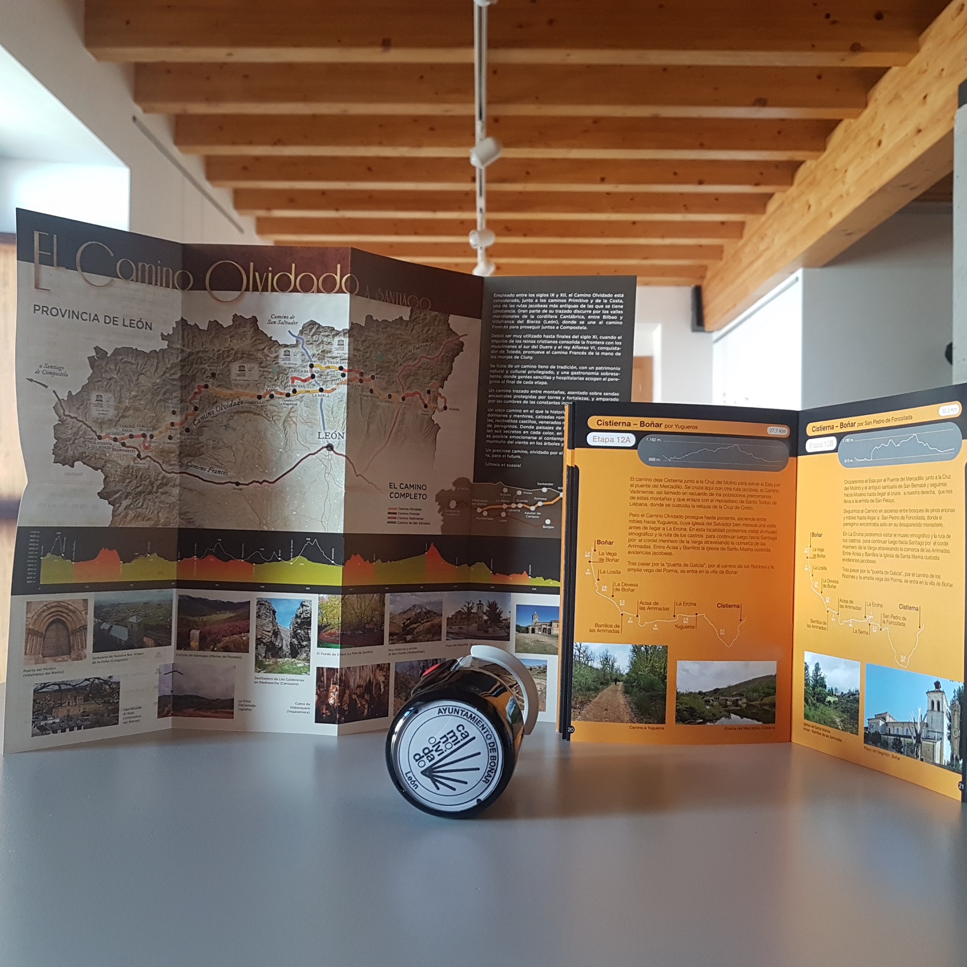
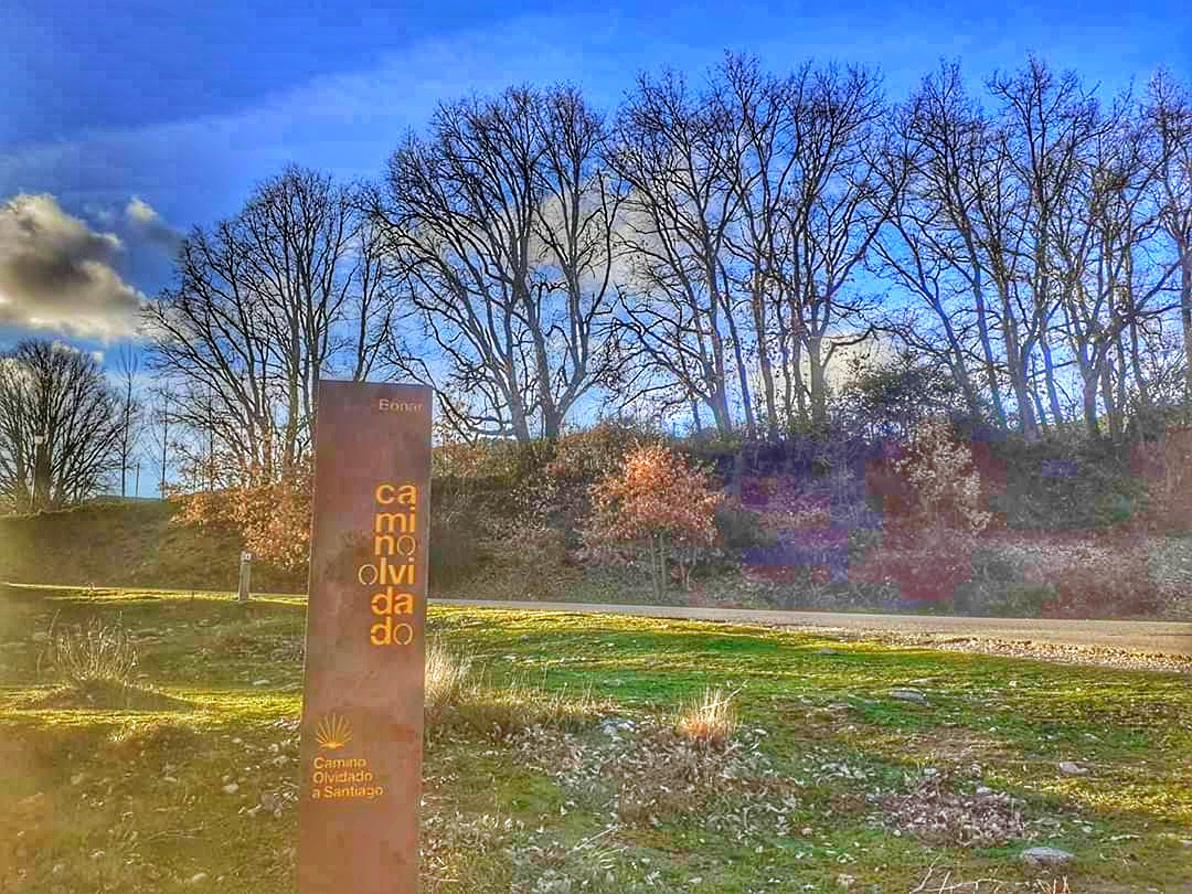
The Camino Olvidado (Forgotten Way) to Santiago de Compostela passes through Boñar
The forgotten trail to Santiago (Camino Olvidado a Santiago) also known as Camino de la Montaña or Camino Viejo is an ancestral route to Santiago de Compostela.
Primitive and wild. Unique and striking. Rescuing from oblivion the old Camino a Santiago that crossed rugged mountains, forests and landscapes shaped by water is gaining more and more hiking enthusiasts and pilgrims. The section starts in Bilbao and crosses Burgos, Cantabria and Palencia before entering and concluding in León.
Almost 700 kilometres of a beautiful trail with dozens of Roman ruins, peaks and plains that produce multiple sensations on the pilgrim. The trail is a Jacobean route that during the Middle Ages was used by pilgrims to protect themselves from Almanzor’s Muslims. As the Reconquest advanced over the Muslim kingdoms, this path became less important in favour of the French path until it was completely forgotten. Today, with a unique landscape, the municipalities through which it passes have decided to relaunch it and, therefore, have signposted and prepared it so that those who wish to follow its trails can do so once again. Puente Almuhey, Cistierna, Boñar, La Robla, Canales-La Magdalena, Riello, Fasgar, Igüeña, Labaniego, Congosto, Cabañas Raras and Villafranca, where it joins the French path, form part of the León sections, which also offer Vegacervera and Buiza as alternatives.
Photo gallery
Of the Camino Olvidado
News about our trails
No Results Found
The page you requested could not be found. Try refining your search, or use the navigation above to locate the post.