

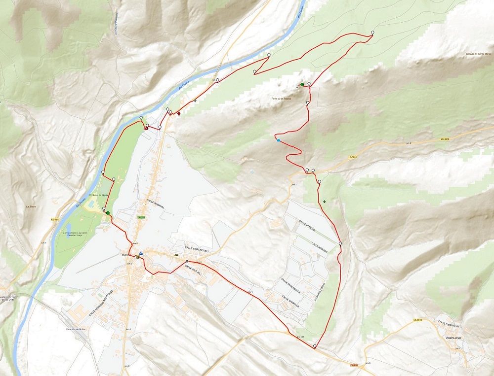
The 4 cardinal points
Hiking trails in the municipality of Boñar

The 4 cardinal points
Hiking Trails
The 4 cardinal points
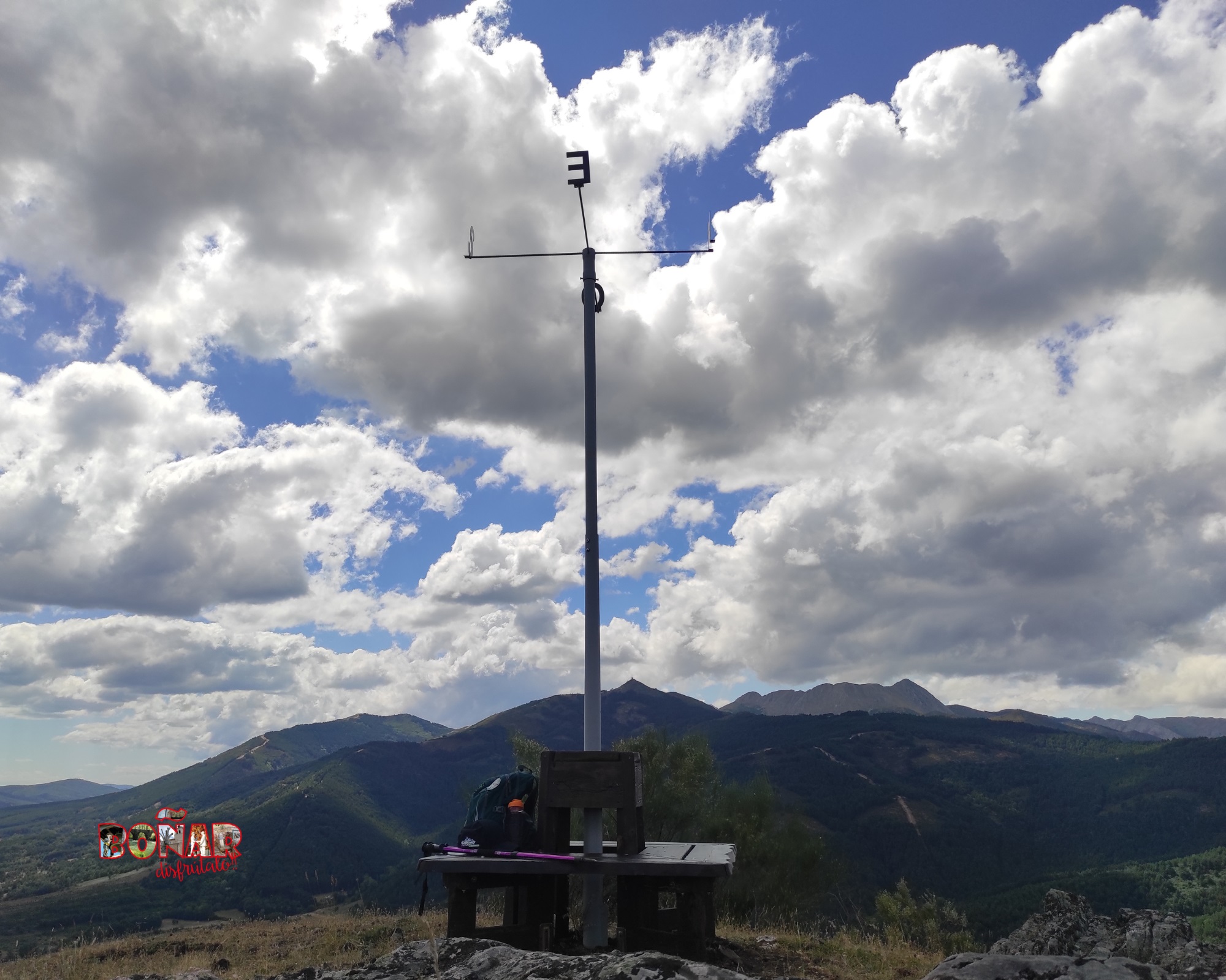
SEEKING THE NORTH
Boñar is pure hiking, all year round!
Discover Boñar
from its 4 cardinal points
with its wonderful
views.
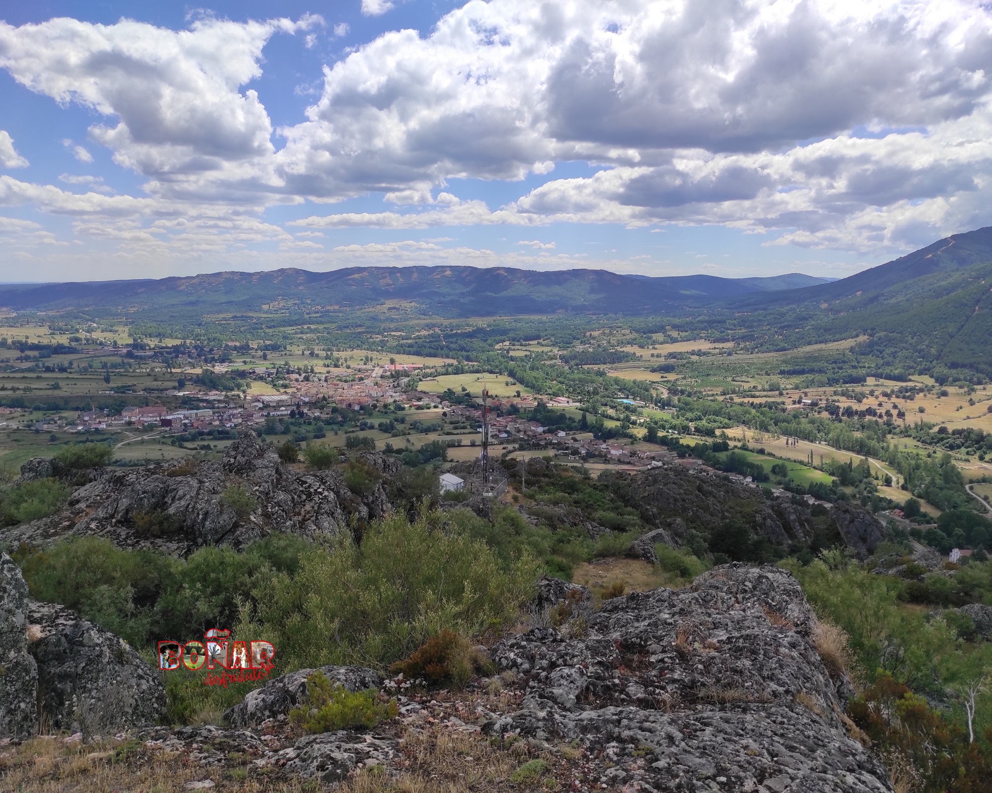
Hiking trail created to enjoy one of the best panoramic views of the village of Boñar. Peña Salona is located at 1241m above sea level.
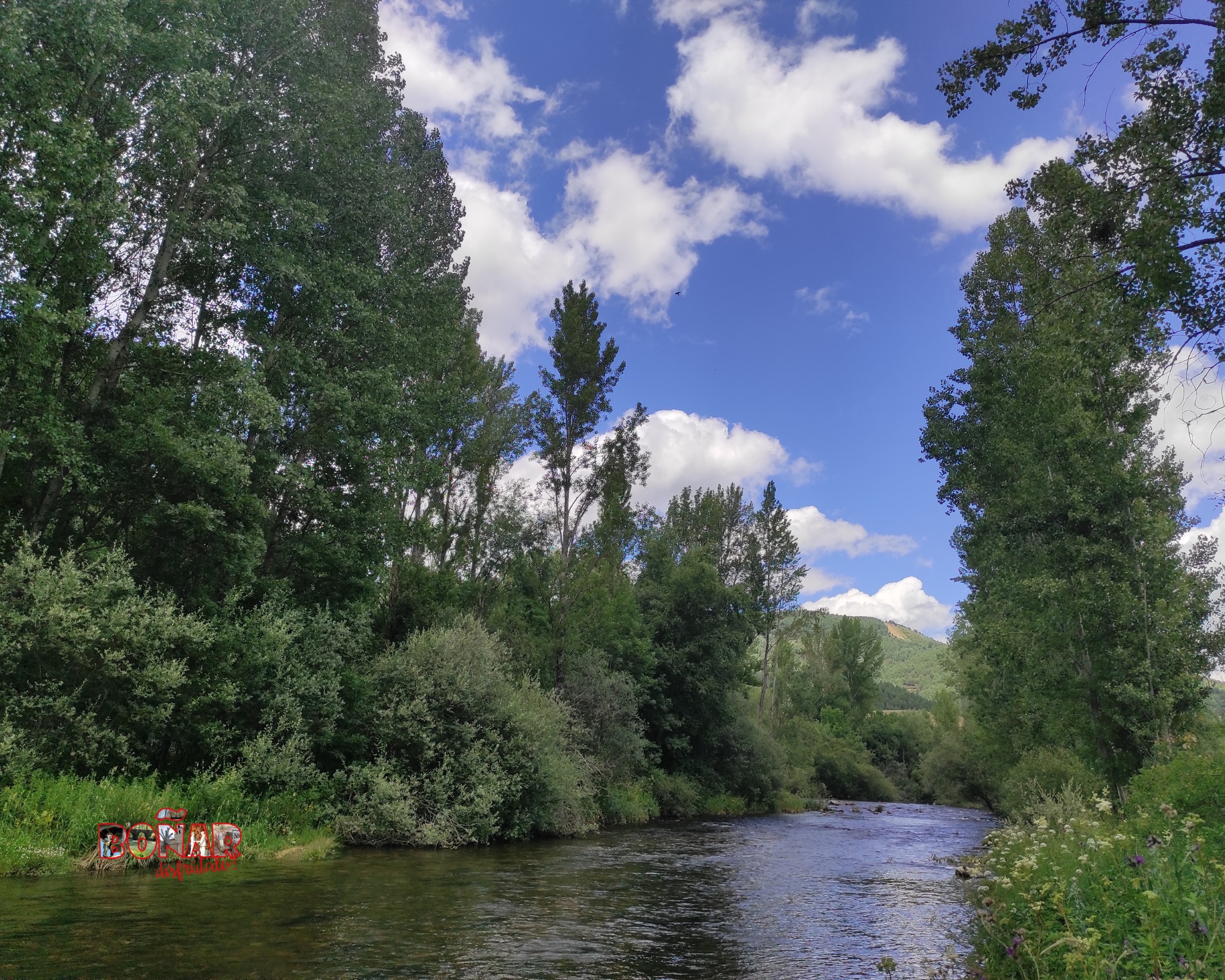
This location allows us to have privileged views of places such as: Pico Cueto, Pico Susarón, the village of Boñar, the village of Cerecedo and enjoy the hike of the Porma River through our municipality.
Its strategic location, allows access to the Peña Salona, by multiple trails and all of them, will lead you to enjoy nature and wonderful views.

Check the weather before you go…
OFFICIAL trail information
Type of trail:
Circular.
Starting point:
El Soto de Boñar.
Arrival point:
El Soto de Boñar.
Approximate duration:
Aprox. 3,5 hours.
Slope:
273 meters.
Type of trail:
Forest trail.
Recommended activity:
Pedestrian and cycling.
Difficulty:
Moderate.
Recommended time of year:
All year round, except with snow.
Maximum altitude:
1241 meters.
Minimum altitude:
971 meters..
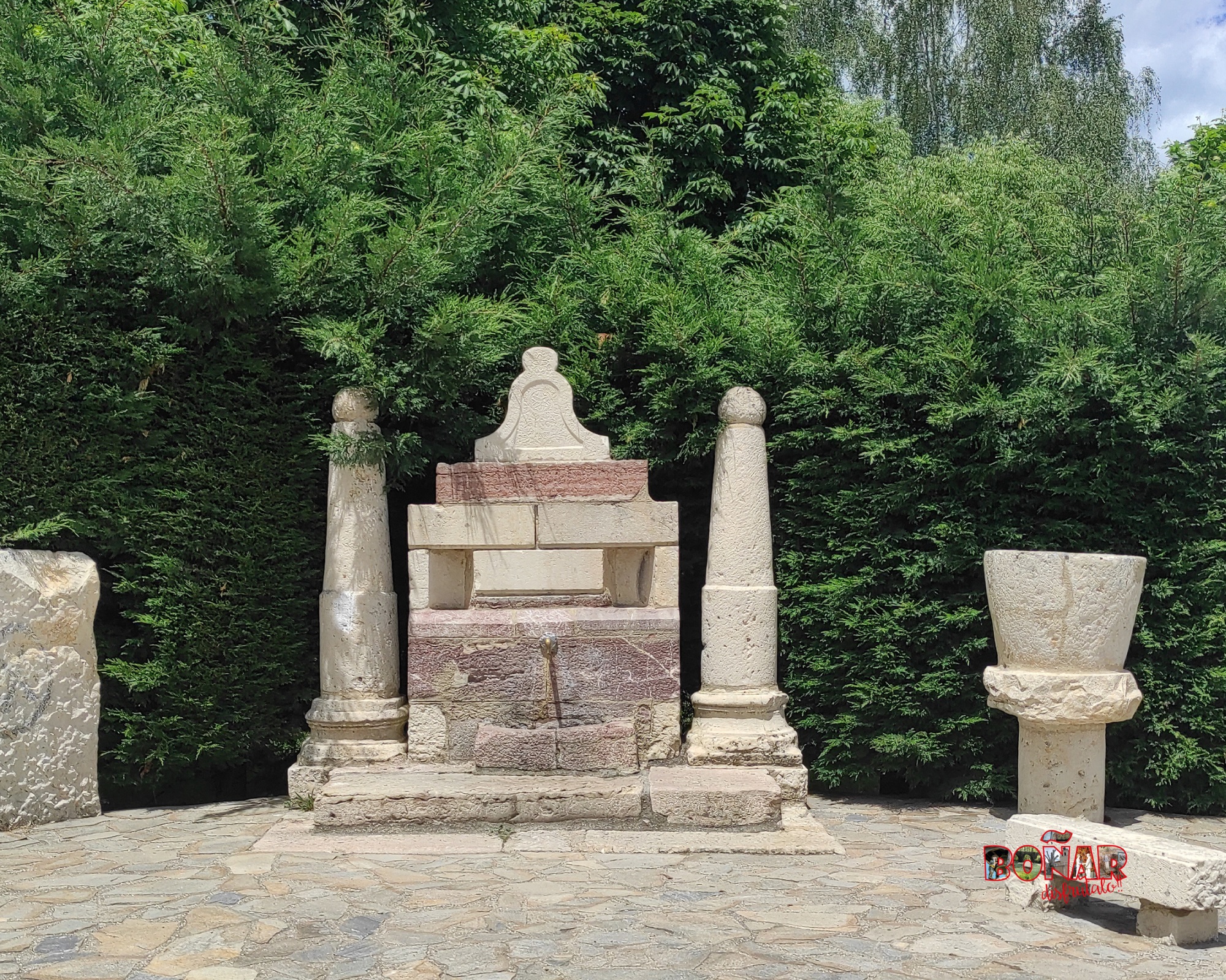
We start the trail in the parking lot of the recreational park El Soto, continue along the central road, leaving the “Fuente los Pueblos del Pantano” on the right. During this stretch, we will find the entrance to the swimming pool, the soccer field and we will enjoy a pleasant walk along the banks of the river Porma, at the end of the trail, we will find a sign, which tells us that we must turn right, to head towards the old power plant.
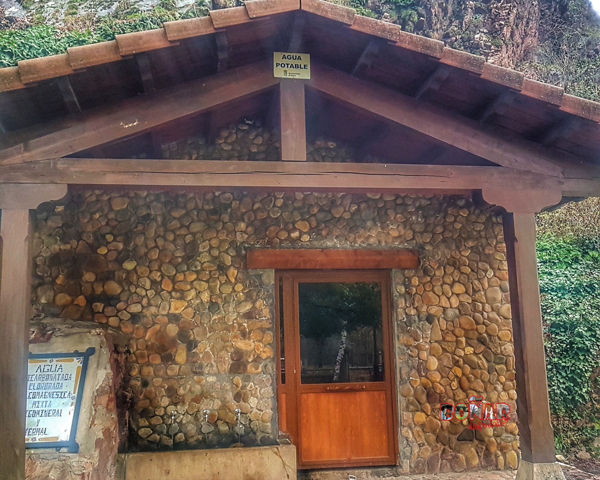
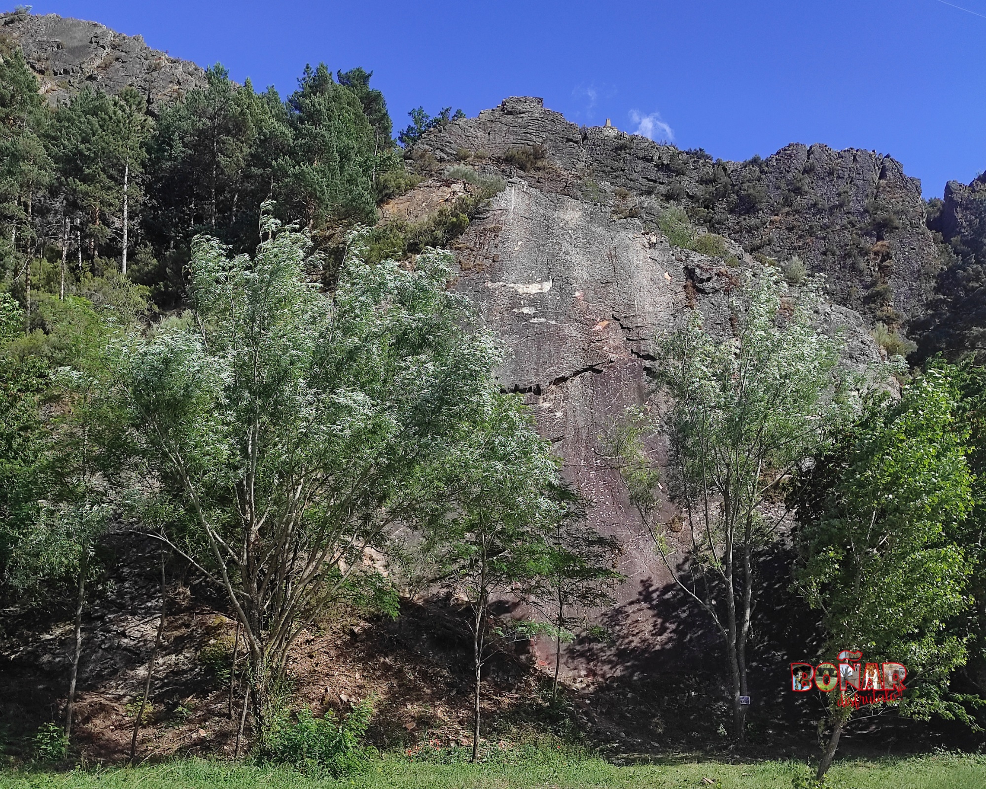
The route will lead us to Calda 2, where visitors can refresh themselves with the pure water of Boñar. Continuing our way we will see a vertical climbing wall on the slope of Peña Salona.
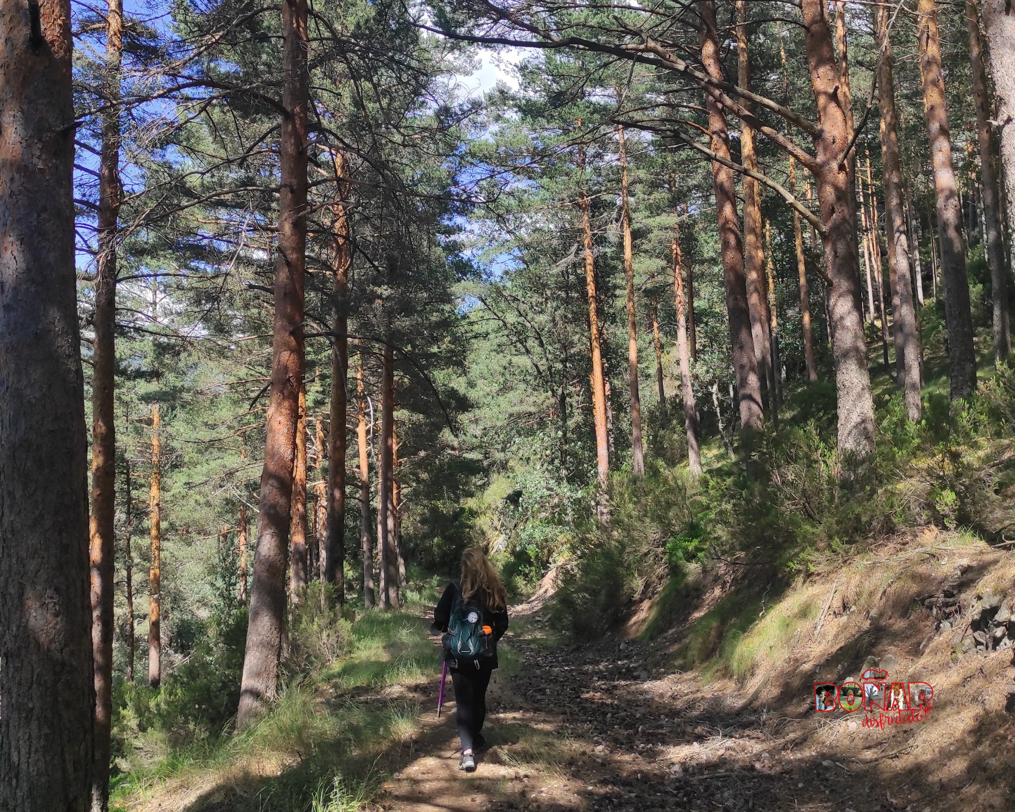
The signs will guide us to take the trail that will lead us to the 4 cardinal points, from that point we can see a rich vegetation composed of Scots pine (Pinus Sylvestris), Mediterranean oak (Quercus rotundifolia), oak or Pyrenean oak (Quercus Pyrenaica) and Cantabrian heather (daboecia cantabrica).
The ascent to Peña Salona, located at 1246 m altitude, allows you to admire a wonderful panoramic view of the town of Boñar, the course of the Porma River, the village of Cerecedo and the silica mine in Valdecastillo.
On our way down, we will find the Arbolin fountain, a place of enjoyment among the locals, its ferruginous palate will make you remember it for the rest of the trail. We will continue our descent, which will take us to the Pinar de Adrados, another place of recreation of the town, where you can enjoy nature and the many trails, existing in this spectacular area.
We continue to the area of Pormasol, a residential enclave, where all the streets are named after the villages that were flooded by the construction of the Juan Benet Dam or Porma Dam.
Before ending the route, we will find the old national schools (currently used as a public library, coworking area and multipurpose room).

The trail in photos


When it feels good to stray in the right direction!
Explore other great hiking trails here!!
PRC-LE 55
Ascensión a Pico Cueto
PRC LE-56
Por el Río Porma
PRC-LE 57
Las Ermitas
PRC-LE 58
Adrados to vozmediano
PRC-LE 59
Por Valdehuesa
SL-LE 1
Cascada de Foces
SL-LE 2
Cota del Campillo
SL-LE 3
Literary Hike – Rucayo to Utrero
SL-LE 4
La ermita de san pelayo
SL-LE 5
C. tradicional – Veneros a Llama
SL-LE 6
Ruta por el Pinar de Villares
Trail with Water
Trail with Water