

PRC-LE 58 – Adrados a vozmediano
Hiking trails in the municipality of Boñar
Adrados to vozmediano
Hiking Trails
PRC-LE 58 – Adrados a vozmediano
Check the weather before you go…
Trail Information

Type of trail:
Circular.
Starting point:
Adrados.
Arrival point:
Vozmediano.
Approximate duration:
Aprox. 5 hours and 30 minutes. 11.8 km.
Slope:
350 metres.
Type of trail:
Forest trail.
Recommended activity:
Pedestrian and cycling.
Difficulty:
Moderate.
Recommended time of year:
All year round, except with snow.
Maximum altitude:
1071 meters.
Minimum altitude:
971 meters.
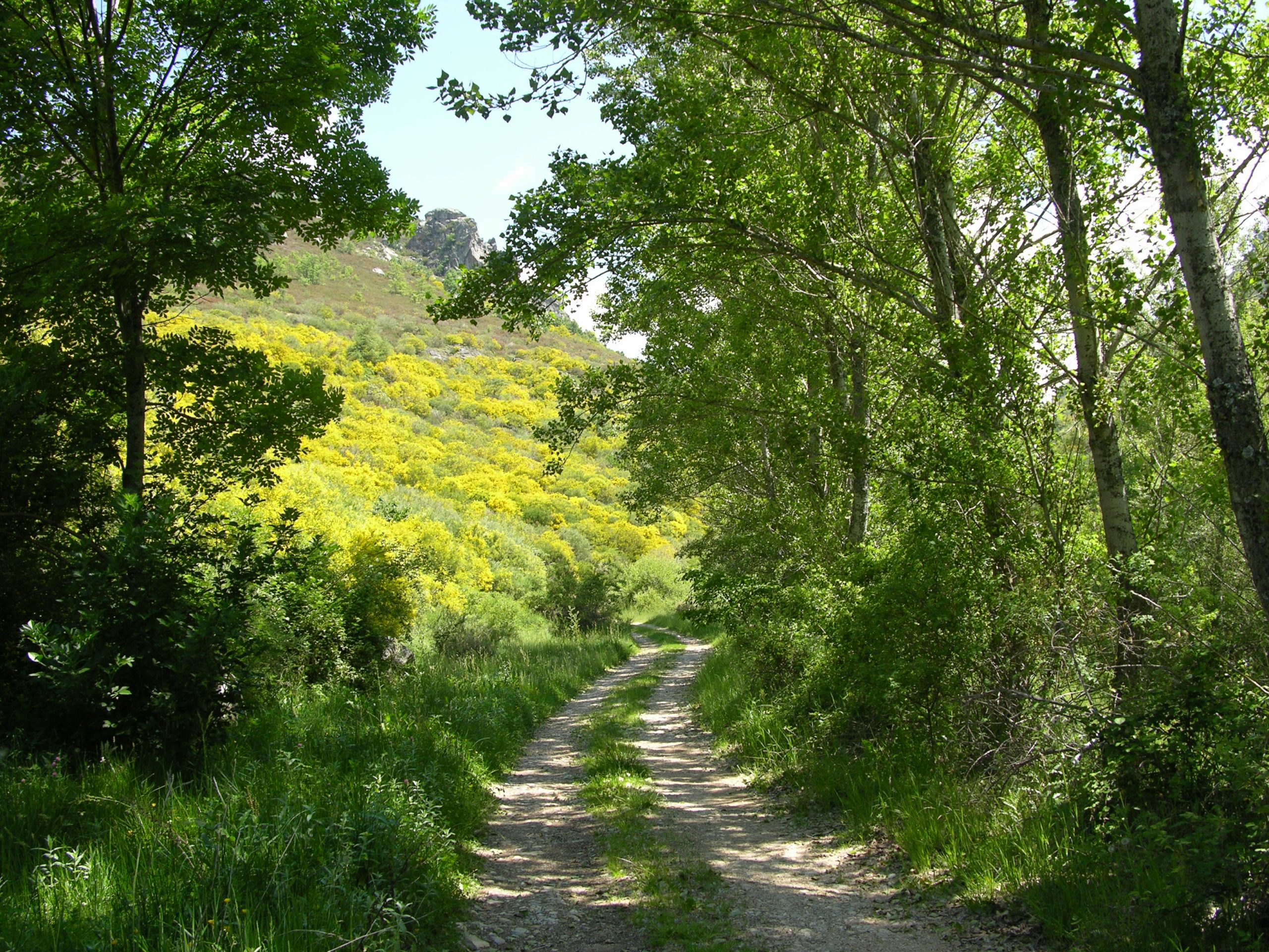
Leaving Adrados, cross the village along the main street without turning off at any time until you reach the first crossroads, where you take the path on the right that will lead you along a valley floor. Here, between stone barriers, beeches, oaks and Majuelos, you will gain height until you reach the hill of Santa María, the dividing point of the Traditional Path from Adrados to Vozmediano.
From this point we can contemplate the valley of small farms that have fallen into disuse due to the decline of livestock in the region. In this place you can see some peculiar stone constructions halfway up the hillside in the shape of small huts that nowadays are used by shepherds to shelter from the wind and rain.
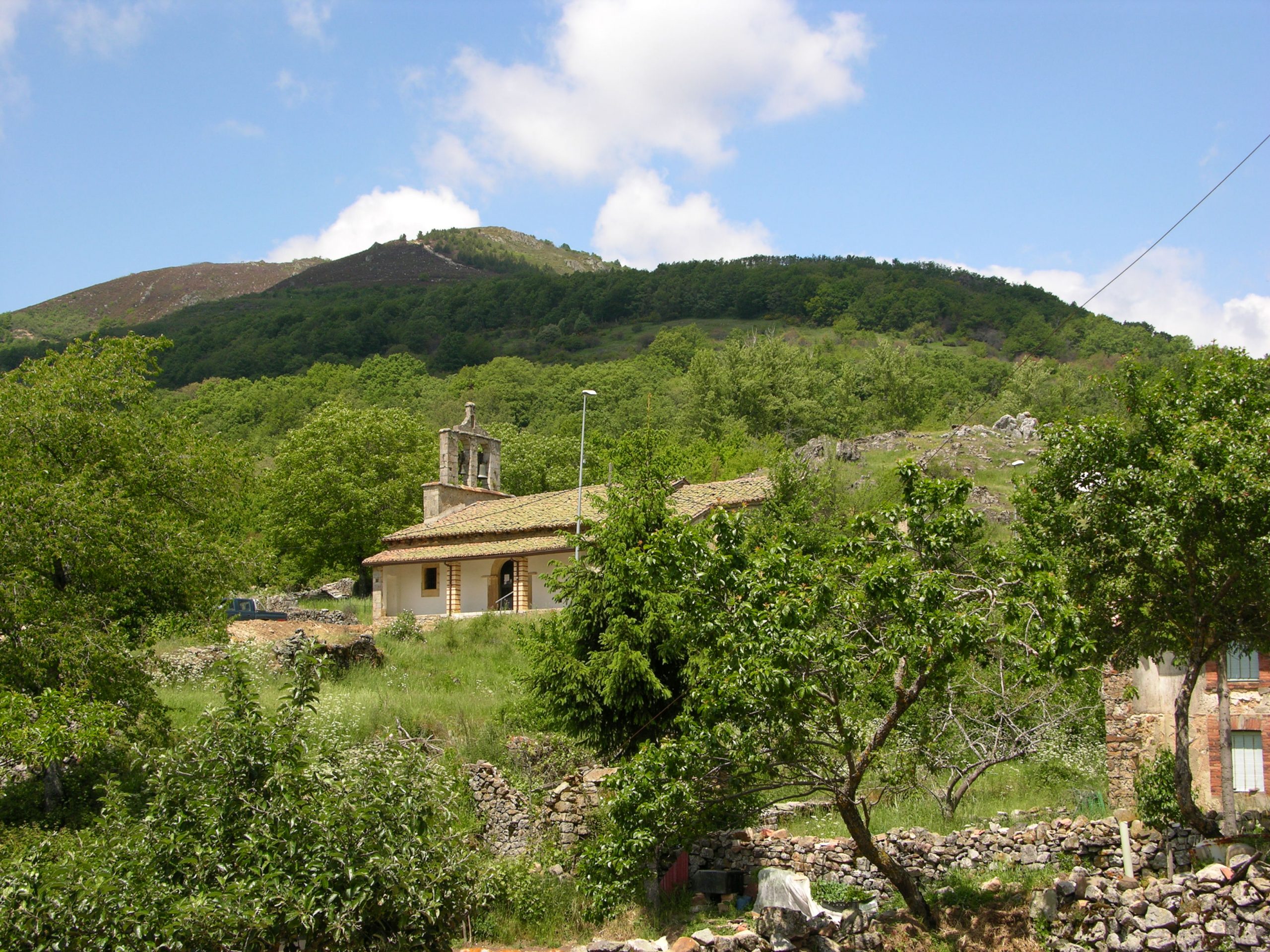
Once we have begun the descent along the path you will find the village of Vozmediano, where the Church of San Pedro welcomes you.
Following the trail you will cross the narrow bridge that leads to the centre of the village and turning left you will have to continue towards the exit of the village, to begin the ascent along the narrow path that starts at the first crossroads on the left and on which, escorted from the beginning by oaks and pines, you will reach an important mass of Scots pine, also called Pino de Lillo, which forms part of the protected area of the Pardomino mountains. Translated with www.DeepL.com/Translator (free version)
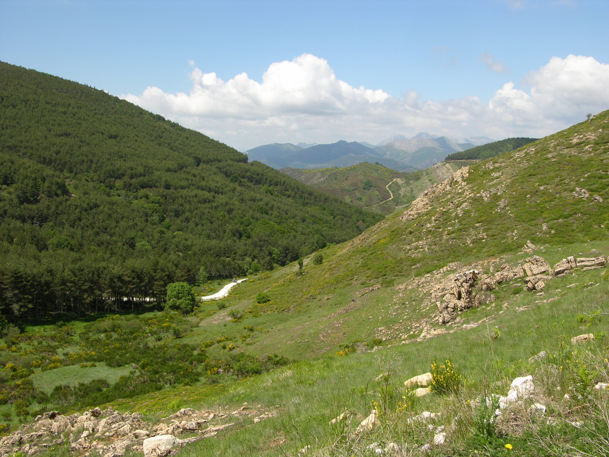
Well into the pine forest and turning left at the junction that marks the steepest stretch of the trail, we reach the highest point of the entire course;
The Collado del Arvejal, also called the Collado de Sillares, where the stream with the same name has its source and from where you have an unparalleled view of the Cantabrian Mountains.
Following the trail, a slight and continuous descent begins in which you will find once again the well-formed Scots pine forest which, alternating in the deepest areas of the valley with oaks, birches and even beeches, will lead you gradually back to the crossroads taken at the beginning of the trail and thus to Adrados.
It is advisable to bring warm clothing, appropriate footwear, water and food as well as sunscreen.
Near the trail is the Pardomino Forest. This area belongs to the Riaño and Mampodre Regional Park and is a protected area, for this reason it is advisable not to leave the itinerary.
Photos of the trail
Water is the driving force of all nature.
Explore other great hiking trails here!!
PRC-LE 55
Ascensión a Pico Cueto
PRC LE-56
Por el Río Porma
PRC-LE 57
Las Ermitas
PRC-LE 58
Adrados to vozmediano
PRC-LE 59
Por Valdehuesa
SL-LE 1
Cascada de Foces
SL-LE 2
Cota del Campillo
SL-LE 3
Literary Hike – Rucayo to Utrero
SL-LE 4
La ermita de san pelayo
SL-LE 5
C. tradicional – Veneros a Llama
SL-LE 6
Ruta por el Pinar de Villares
Trail with Water
Trail with Water