

SL-LE 3 : Ruta Literaria – Rucayo a Utrero
Hiking trails in the municipality of Boñar
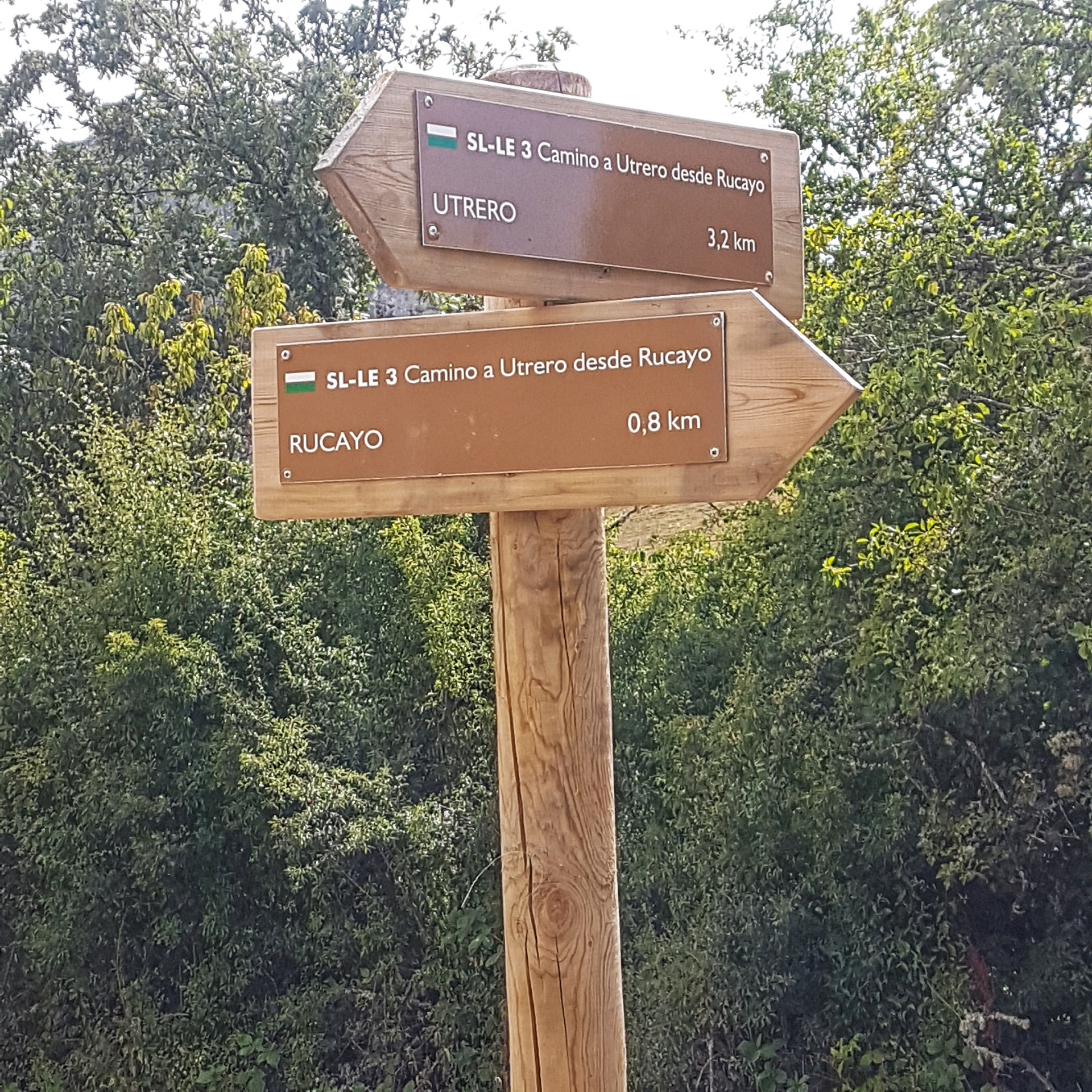
Rucayo a Utrero
Hiking Trails
SL-LE 3 : Ruta Literaria – Rucayo a Utrero
Check the weather before you go…
Trail Information
Type of trail:
Linear. One Way.
Starting point:
Rucayo.
Arrival point:
Utrero.
Approximate duration:
Aprox. 1 hour and 40 minutes. 4,0 km.
Slope:
Ascent 130 metres and descent 115 metres.
Type of trail:
Forest trail.
Recommended activity:
Pedestrian and cycling.
Difficulty:
Low.
Recommended time of year:
All year round, except with snow.
Maximum altitude:
1071 meters.
Minimum altitude:
971 meters.
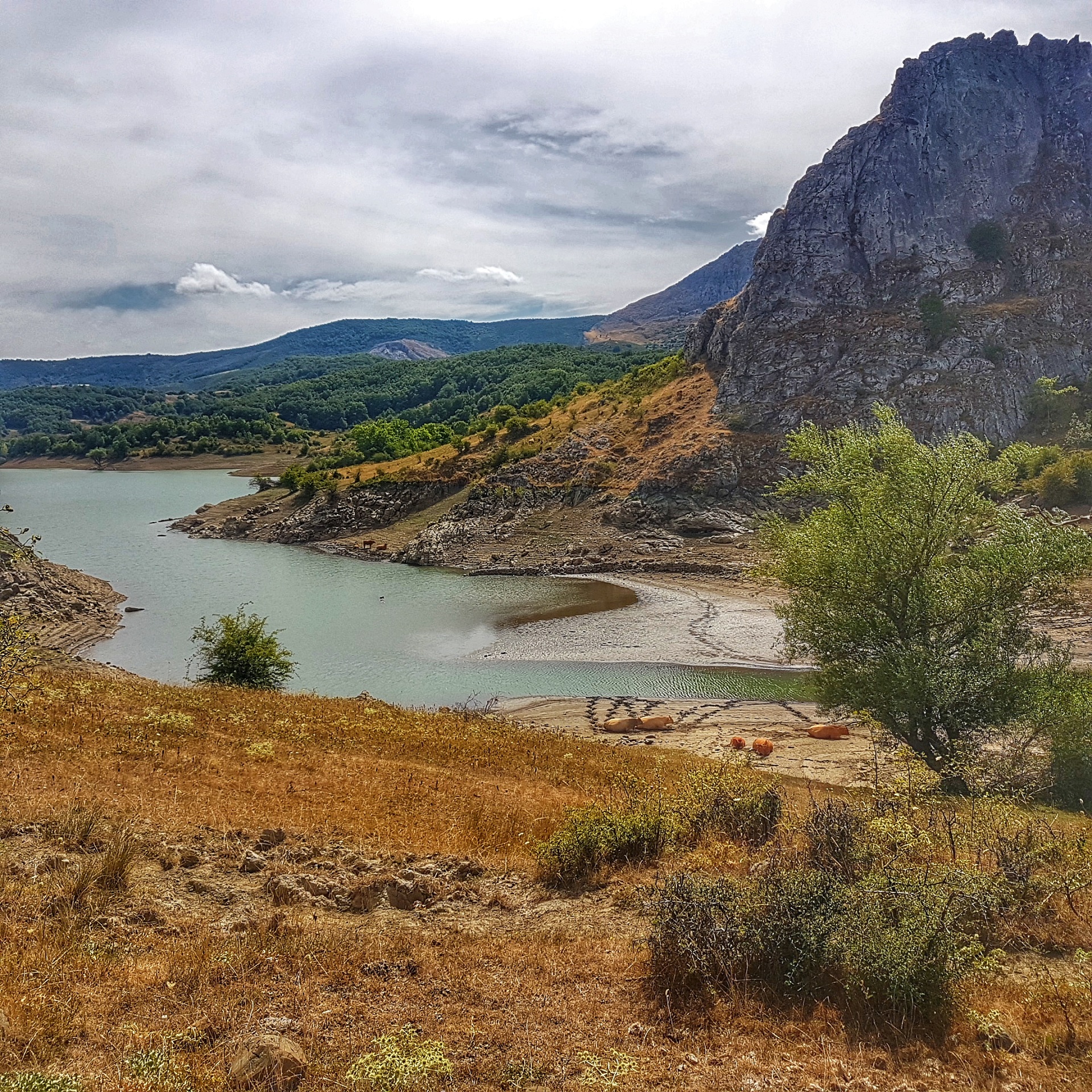
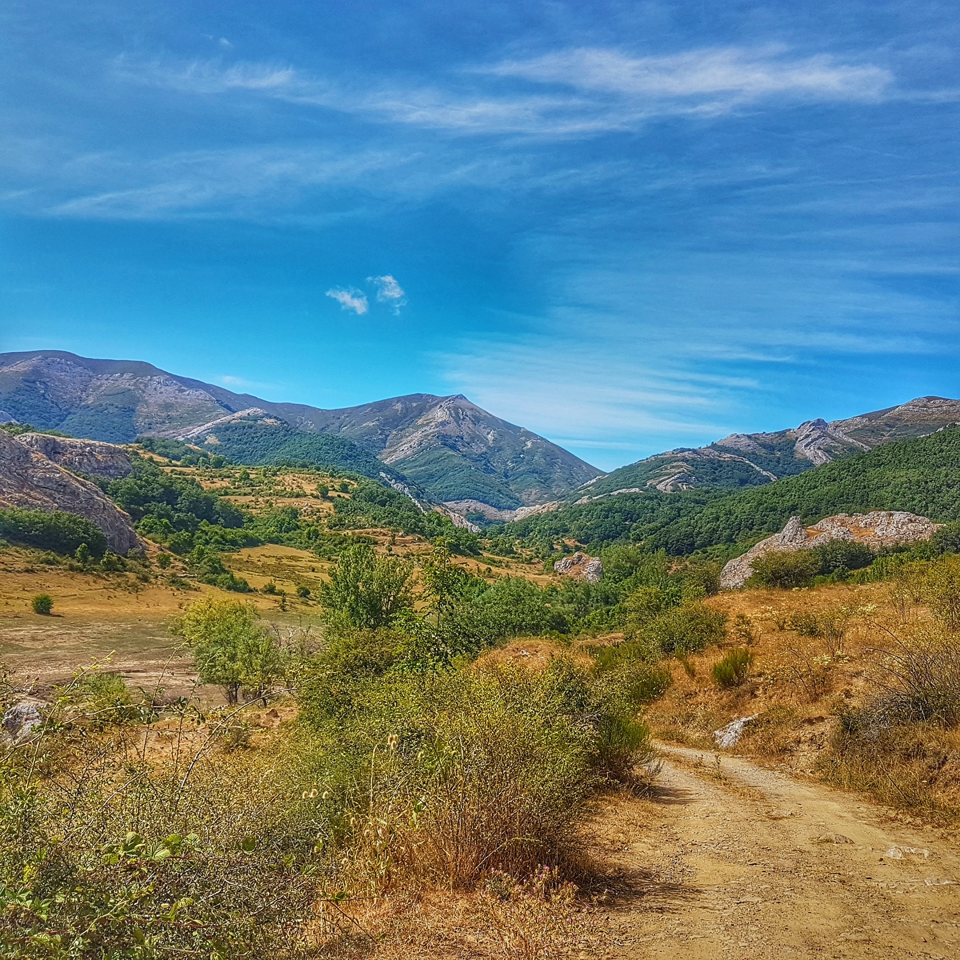
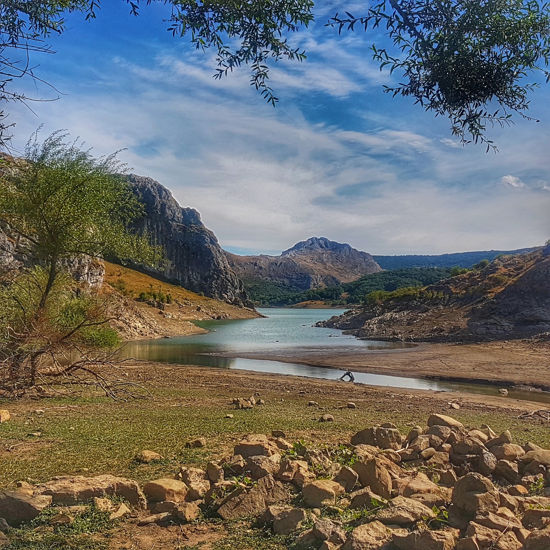
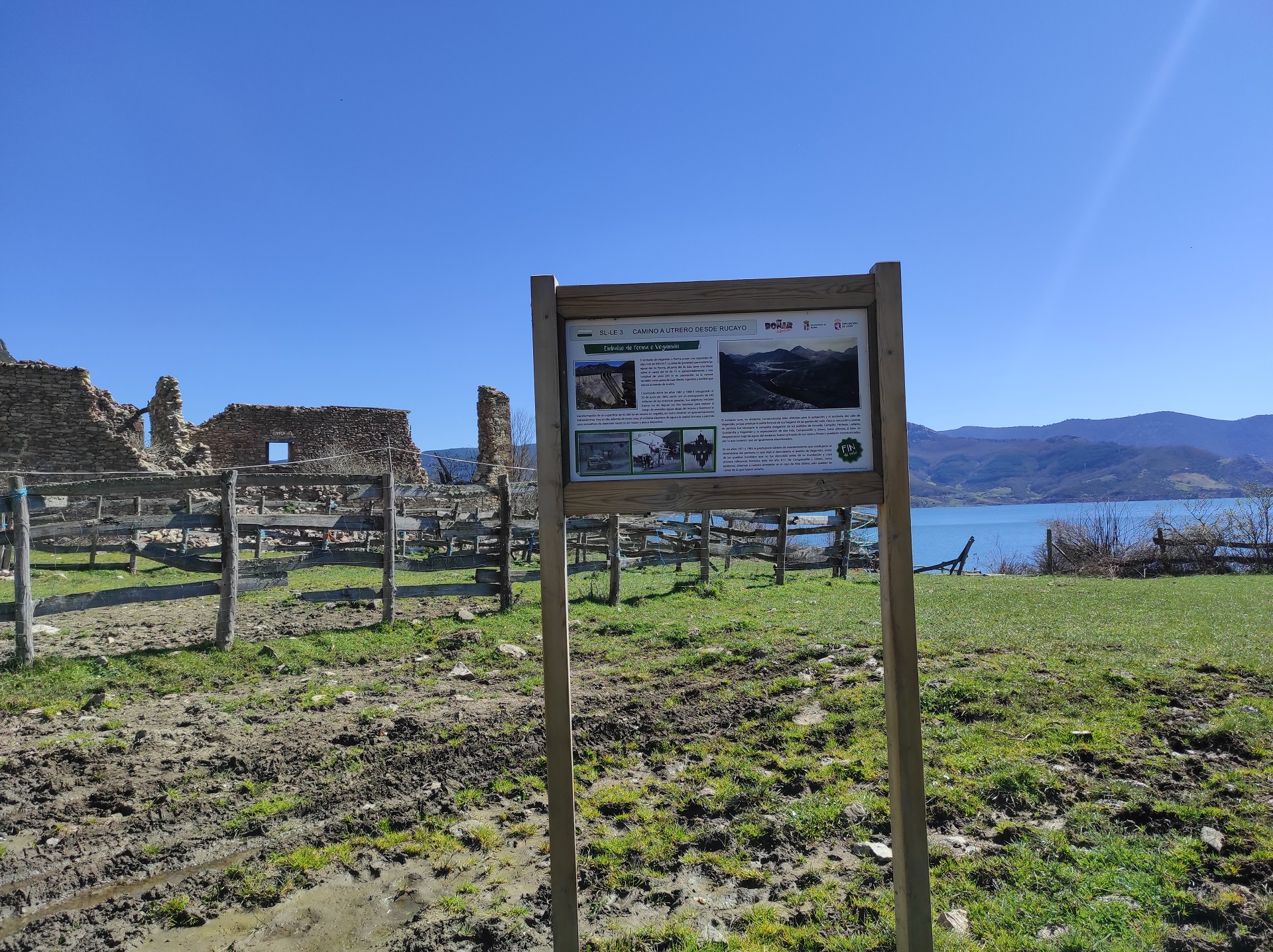
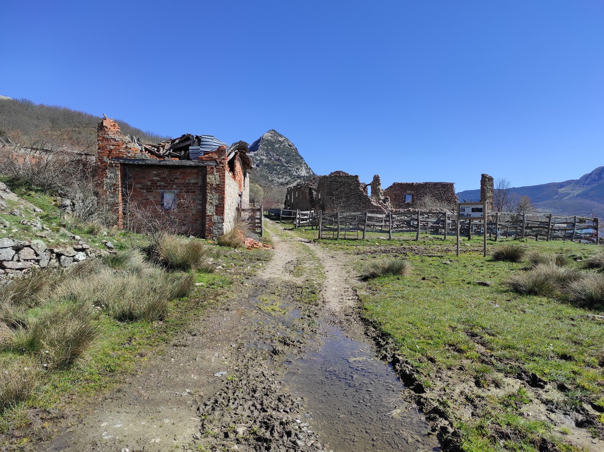
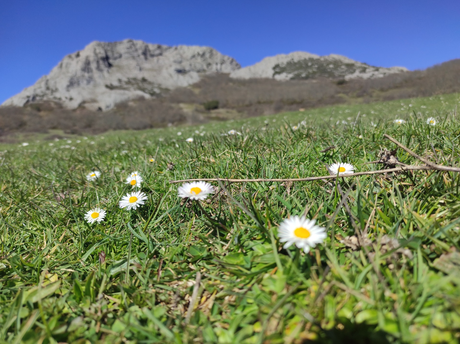
The trail SL-LE 3 Camino a Utrero desde Rucayo runs in the heart of the Cantabrian Mountains, between the El Regalar mountain and the Porma Dam reservoir. The trail is just over 8 km long, and its main attraction are the traditional uses of the land for livestock, farming and the use of the forest, with meadows with their natural enclosures, or sebes, and the oak forest (Quercus pryrenaica) standing out in the landscape. We finish the trail in Utrero, a village abandoned after the construction of the water dam. From this village there is an exceptional view of the entire reservoir and the Friera river valley, including fantastic views of the limestone peaks of Peña Forcada (1,721 metres) on its eastern side.
The trail starts in the eastern part of the village of Rucayo. The start is marked by an information panel at the beginning of the trail. It runs along a well-defined track, with a compacted surface and a sufficient width to allow vehicles to pass. The trail overlaps almost the entire route with the old PR-LE 15.
The first junction is just 40 metres from the start. To continue our trail, we only have to proceed straight on. The next junction is 800 metres from the starting point and at a crossroads of pathways giving access to the surrounding plots of land. These plots are one of the main attractions of the trail, as we can observe the traditional ways and constructions of the area, such as the living enclosures, known as sebes.
The last junction, located 500 metres from the end of the trail, separates the new trail from the existing PR-LE 15. Continuing straight on we reach the village of Utrero, abandoned after the construction of the dam. At this point, we will find an information panel with information of interest about the village, which indicates the end of the trail. Finally, we will return along the same itinerary.
The main crossroads of the trail are marked with directional arrows to show the correct direction. It should be noted that in wet weather you may encounter large amounts of mud along the path, which will make it difficult to walk.
It is advisable to bring warm clothing, comfortable hiking shoes, water and food as well as sunscreen.
It is also advisable to take binoculars and a camera to see and record the existing great variety of landscapes and species of fauna and flora.
Photos of the trail

What are we to rocks and mountains?
Explore other great hiking trails here!!
PRC-LE 55
Ascensión a Pico Cueto
PRC LE-56
Por el Río Porma
PRC-LE 57
Las Ermitas
PRC-LE 58
Adrados to vozmediano
PRC-LE 59
Por Valdehuesa
SL-LE 1
Cascada de Foces
SL-LE 2
Cota del Campillo
SL-LE 3
Literary Hike – Rucayo to Utrero
SL-LE 4
La ermita de san pelayo
SL-LE 5
C. tradicional – Veneros a Llama
SL-LE 6
Ruta por el Pinar de Villares
Trail with Water
Trail with Water